File:Badghis province detail map.png

File originale (985 × 619 pixel, dimensione del file: 112 KB, tipo MIME: image/png)
| Questo file e la sua pagina di descrizione (discussione · modifica) si trovano su Wikimedia Commons (?) |
Dettagli
| Descrizione |
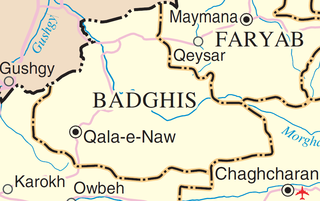
English: Map of Badghis Province, Afghanistan
Adapted from http://www.un.org/Depts/Cartographic/map/profile/afghanis.pdf |
|||
| Fonte | http://www.un.org/Depts/Cartographic/map/profile/afghanis.pdf | |||
| Autore | Delehaye | |||
| Licenza (Riusare questo file) |
|

Cronologia del file
Fare clic su un gruppo data/ora per vedere il file come si presentava nel momento indicato.
| Data/Ora | Miniatura | Dimensioni | Utente | Commento | |
|---|---|---|---|---|---|
| attuale | 21:45, 30 lug 2011 | | 985 × 619 (112 KB) | Delehaye | {{Information |Description ={{en|1=Map of Badghis Province, Afghanistan Adapted from http://www.un.org/Depts/Cartographic/map/profile/afghanis.pdf {{UN map}} Category:Maps of Farah Province}} |Source ={{own}} |Author =[[User:Dele |
| 21:45, 30 lug 2011 |  | 985 × 619 (112 KB) | Delehaye | {{Information |Description ={{en|1=Map of Badghis Province, Afghanistan Adapted from http://www.un.org/Depts/Cartographic/map/profile/afghanis.pdf {{UN map}} Category:Maps of Farah Province}} |Source ={{own}} |Author =[[User:Dele |
Pagine che usano questo file
La seguente pagina usa questo file: