File:Har Nuur.jpg
File originale (2 152 × 1 336 pixel, dimensione del file: 754 KB, tipo MIME: image/jpeg)
| Questo file e la sua pagina di descrizione (discussione · modifica) si trovano su Wikimedia Commons (?) |
Dettagli
| Descrizione |
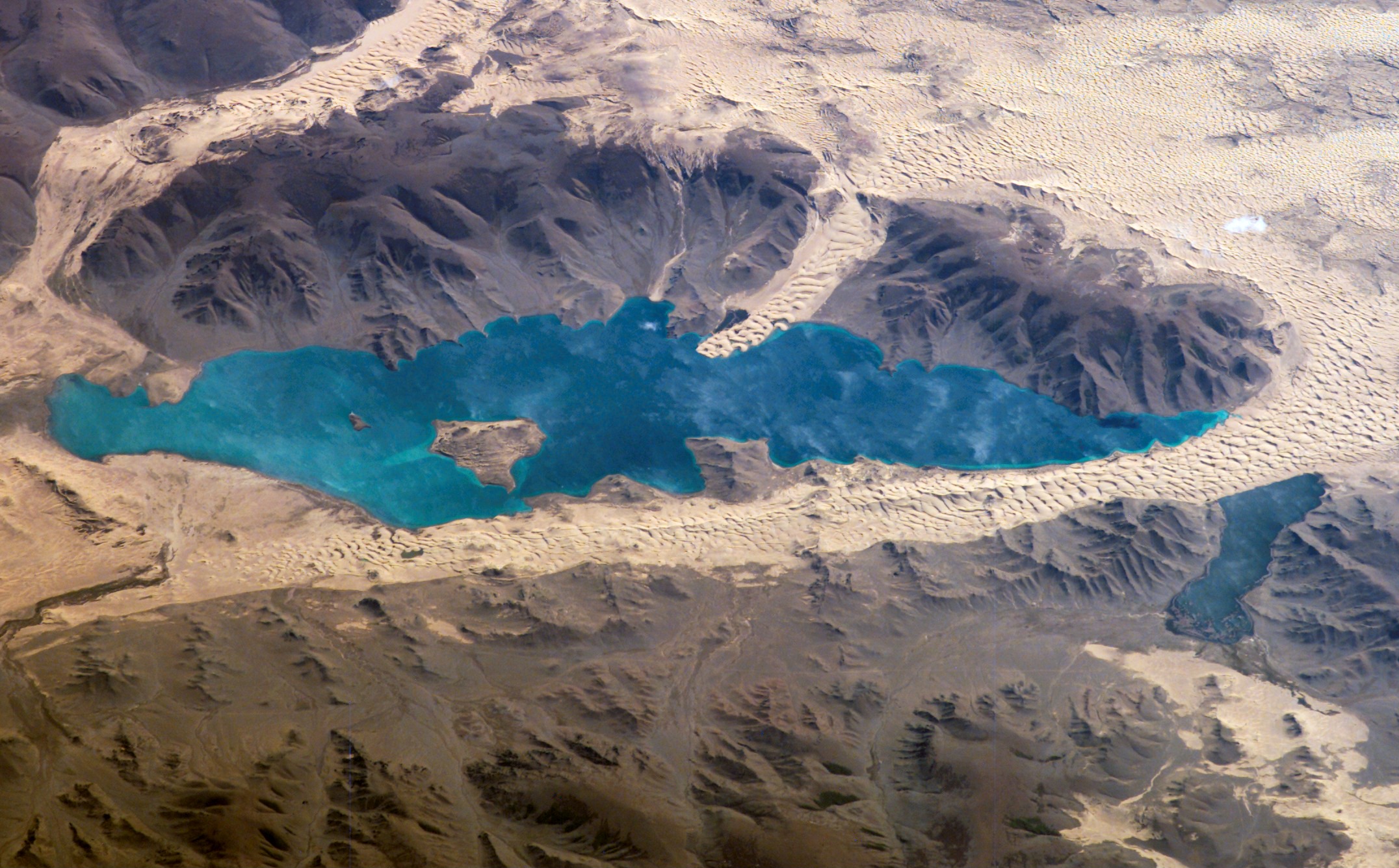
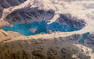
English: Image caption and information available at [1]
Khar Nuur, or the Black Lake, is located in western Mongolia's Valley of Lakes, part of a system of closed basins stretching across central Asia. These basins are the remnants of larger paleolakes (paleo- means "ancient") that began to shrink approximately 5,000 years ago as regional climate became drier. Like other lakes in the region, Khar Nuur relies on precipitation, growing in the spring and shrinking in the summer. This process of growth and shrinkage produces a variety of wetland habitats, as well as resting points for large numbers of migratory birds. This photograph captures the dynamic nature of the landscape of Khar Nuur. The lake is encircled by sand dune fields that encroach on the lower slopes of the Tovkhosh Mountains to the west and south. Gaps in the mountains have been exploited by sand dunes moving eastward, indicating westerly winds. The most striking example is a series of dunes entering Khar Nuur along its southwestern shoreline. Here, the dunes reflect the channeling of winds through the break in the mountain ridgeline, leading to dune crests lying perpendicular to northwesterly winds. Another well-developed line of dunes appears between Khar and Baga Lakes; while these dunes appear to cut across a lake surface, the dunes have in fact moved across a narrow stream channel. This image was acquired Sept. 7, 2006, by the crew of the International Space Station Kodak 760C digital camera using a 400 mm lens, [1] Image credit: NASA |
| Data | |
| Fonte | https://eol.jsc.nasa.gov/SearchPhotos/photo.pl?mission=ISS013&roll=E&frame=78506 |
| Autore | NASA |
| Altre versioni | Image:Khar-Nuur, Mongolia, hi-res.JPG |
Licenza
"The Gateway to Astronaut Photography of Earth". Le immagini provengono dall'Image Science & Analysis Laboratory, della NASA Johnson Space Center.
Fonte della foto: ISS013-E-78506.
|
Registro originale del caricamento
- 2006-10-17 19:45 Niro5 1000×618×8 (210556 bytes) Image caption and information available at [http://www.nasa.gov/multimedia/imagegallery/image_feature_677.html] Khar Nuur, or the Black Lake, is located in western Mongolia's Valley of Lakes, part of a system of closed basins stretching across central As
Cronologia del file
Fare clic su un gruppo data/ora per vedere il file come si presentava nel momento indicato.
| Data/Ora | Miniatura | Dimensioni | Utente | Commento | |
|---|---|---|---|---|---|
| attuale | 22:54, 25 apr 2019 | | 2 152 × 1 336 (754 KB) | Ras67 | high resolution |
| 09:49, 7 mag 2007 |  | 1 000 × 618 (206 KB) | Latebird | {{Information |Description={{En|Image caption and information available at [http://www.nasa.gov/multimedia/imagegallery/image_feature_677.html] Har Nuur, or the Black Lake, is located in western Mongolia's Valley of Lakes, part of a system of closed basi |
Pagine che usano questo file
La seguente pagina usa questo file:
Utilizzo globale del file
Anche i seguenti wiki usano questo file:
- Usato nelle seguenti pagine di ar.wiki.x.io:
- Usato nelle seguenti pagine di azb.wiki.x.io:
- Usato nelle seguenti pagine di ca.wiki.x.io:
- Usato nelle seguenti pagine di ceb.wiki.x.io:
- Usato nelle seguenti pagine di cs.wiki.x.io:
- Usato nelle seguenti pagine di de.wiki.x.io:
- Usato nelle seguenti pagine di en.wiki.x.io:
- Usato nelle seguenti pagine di es.wiki.x.io:
- Usato nelle seguenti pagine di eu.wiki.x.io:
- Usato nelle seguenti pagine di fa.wiki.x.io:
- Usato nelle seguenti pagine di he.wiki.x.io:
- Usato nelle seguenti pagine di hu.wiki.x.io:
- Usato nelle seguenti pagine di incubator.wikimedia.org:
- Usato nelle seguenti pagine di ka.wiki.x.io:
- Usato nelle seguenti pagine di mn.wiki.x.io:
- Usato nelle seguenti pagine di no.wiki.x.io:
- Usato nelle seguenti pagine di pa.wiki.x.io:
- Usato nelle seguenti pagine di pl.wiki.x.io:
- Usato nelle seguenti pagine di pt.wiki.x.io:
- Usato nelle seguenti pagine di ro.wiki.x.io:
- Usato nelle seguenti pagine di ru.wiki.x.io:
- Usato nelle seguenti pagine di sco.wiki.x.io:
- Usato nelle seguenti pagine di sv.wiki.x.io:
- Usato nelle seguenti pagine di ta.wiki.x.io:
- Usato nelle seguenti pagine di tr.wiki.x.io:
- Usato nelle seguenti pagine di tt.wiki.x.io:
- Usato nelle seguenti pagine di uk.wiki.x.io:
- Usato nelle seguenti pagine di ur.wiki.x.io:
- Usato nelle seguenti pagine di www.wikidata.org:
- Usato nelle seguenti pagine di zh-min-nan.wiki.x.io:
- Usato nelle seguenti pagine di zh.wiki.x.io: