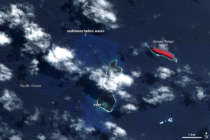
File:Hungatonga aster 20090326.jpg
Hungatonga_aster_20090326.jpg (720 × 480 pixel, dimensione del file: 400 KB, tipo MIME: image/jpeg)
Cronologia del file
Fare clic su un gruppo data/ora per vedere il file come si presentava nel momento indicato.
| Data/Ora | Miniatura | Dimensioni | Utente | Commento | |
|---|---|---|---|---|---|
| attuale | 14:38, 28 mar 2009 |  | 720 × 480 (400 KB) | Tim1965 | {{Information |Description={{en|1=False-color images showing the effects of the eruption of Hunga Tonga-Hunga Ha{{okina}}apai volcano in Tonga, March 26, 2009. The Advanced Spaceborne Thermal Emission and Reflection Radiometer (ASTER) on NASA's Terra sate |
Pagine che usano questo file
La seguente pagina usa questo file:
Utilizzo globale del file
Anche i seguenti wiki usano questo file:
- Usato nelle seguenti pagine di ca.wiki.x.io:
- Usato nelle seguenti pagine di de.wiki.x.io:
- Usato nelle seguenti pagine di en.wiki.x.io:
- Usato nelle seguenti pagine di he.wikivoyage.org:
- Usato nelle seguenti pagine di hr.wiki.x.io:
- Usato nelle seguenti pagine di ja.wiki.x.io:
- Usato nelle seguenti pagine di ko.wiki.x.io:
- Usato nelle seguenti pagine di ms.wiki.x.io:
- Usato nelle seguenti pagine di pt.wiki.x.io:
- Usato nelle seguenti pagine di sl.wiki.x.io:
- Usato nelle seguenti pagine di to.wiki.x.io:
- Usato nelle seguenti pagine di uk.wiki.x.io:
- Usato nelle seguenti pagine di vi.wiki.x.io:
- Usato nelle seguenti pagine di www.wikidata.org:


