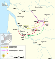
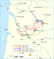
File:Map of Gascon campaign of 1345.svg

Dimensioni di questa anteprima PNG per questo file SVG: 552 × 599 pixel. Altre risoluzioni: 221 × 240 pixel | 442 × 480 pixel | 708 × 768 pixel | 943 × 1 024 pixel | 1 887 × 2 048 pixel | 914 × 992 pixel.
File originale (file in formato SVG, dimensioni nominali 914 × 992 pixel, dimensione del file: 295 KB)
Cronologia del file
Fare clic su un gruppo data/ora per vedere il file come si presentava nel momento indicato.
| Data/Ora | Miniatura | Dimensioni | Utente | Commento | |
|---|---|---|---|---|---|
| attuale | 08:49, 2 ott 2023 |  | 914 × 992 (295 KB) | Lalpino | File uploaded using svgtranslate tool (https://svgtranslate.toolforge.org/). Added translation for ca. |
| 20:53, 9 nov 2021 |  | 914 × 992 (224 KB) | Goran tek-en | View box, font size, color deficiency | |
| 18:56, 19 nov 2018 |  | 914 × 993 (128 KB) | Goran tek-en | {{Information |description ={{en|1=Map of the Gascon campaign of 1345, part of the Hundred Years' War. This map shows the English and French army movements during the campaign and the most important battles.}} |date = |source ={{Own}}<br> Derived from; * [https://www.openstreetmap.org/#map=8/44.678/-0.324 OSM] Information from: * [https://thehistoryofengland.co.uk/2013/09/29/104-lancaster-and-the-battle-of-auberoche/ The history of England] * {{U|Newm30}} |author... |
Pagine che usano questo file
La seguente pagina usa questo file:
Utilizzo globale del file
Anche i seguenti wiki usano questo file:
- Usato nelle seguenti pagine di ca.wiki.x.io:
- Usato nelle seguenti pagine di en.wiki.x.io:
- Usato nelle seguenti pagine di fr.wiki.x.io:
- Usato nelle seguenti pagine di hr.wiki.x.io:
- Usato nelle seguenti pagine di zh.wiki.x.io:


