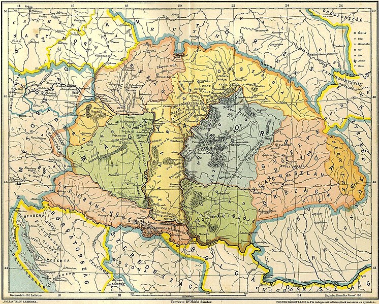
File:Gesta hungarorum map.jpg

Dimensioni di questa anteprima: 746 × 599 pixel. Altre risoluzioni: 299 × 240 pixel | 597 × 480 pixel | 956 × 768 pixel | 1 274 × 1 024 pixel | 2 240 × 1 800 pixel.
File originale (2 240 × 1 800 pixel, dimensione del file: 889 KB, tipo MIME: image/jpeg)
Cronologia del file
Fare clic su un gruppo data/ora per vedere il file come si presentava nel momento indicato.
| Data/Ora | Miniatura | Dimensioni | Utente | Commento | |
|---|---|---|---|---|---|
| attuale | 23:06, 22 mag 2011 |  | 2 240 × 1 800 (889 KB) | WikiEditor2004 | {{Information |Description ={{en|1=Map of Central Europe in the 9th century before arrival of Hungarians, according to Hungarian historian Dr. Márki Sándor. Map reflects data from Gesta Hungarorum chronicle and it show medieval duchies of Braslav, Sa |
Pagine che usano questo file
Le seguenti 6 pagine usano questo file:
Utilizzo globale del file
Anche i seguenti wiki usano questo file:
- Usato nelle seguenti pagine di bg.wiki.x.io:
- Usato nelle seguenti pagine di br.wiki.x.io:
- Usato nelle seguenti pagine di ca.wiki.x.io:
- Usato nelle seguenti pagine di cs.wiki.x.io:
- Usato nelle seguenti pagine di de.wiki.x.io:
- Usato nelle seguenti pagine di en.wiki.x.io:
- Usato nelle seguenti pagine di es.wiki.x.io:
- Usato nelle seguenti pagine di fi.wiki.x.io:
- Usato nelle seguenti pagine di fr.wiki.x.io:
- Usato nelle seguenti pagine di he.wiki.x.io:
- Usato nelle seguenti pagine di hr.wiki.x.io:
- Usato nelle seguenti pagine di hu.wiki.x.io:
- Usato nelle seguenti pagine di mk.wiki.x.io:
- Usato nelle seguenti pagine di pl.wiki.x.io:
Visualizza l'utilizzo globale di questo file.
